The 1730 Survey
Introduction
‘The manors of Sutton [Benger] & Draycott. Inspected in the months of February & March 1730/31 by me Francis Jesse.’
This Survey or Inspection is a document in the Wiltshire and Swindon History Centre (WSHC; reference 970/1). It is a summary of leases at that time, and gives tenant’s name, acreage, field name, state of cultivation, plus type of house, with the value of the property. It is possibly a copy of an original, dating from a couple of years later, with some additions and amendments. Tim Couzens suggests that it was possibly created as part of the administration of the Will of Sir James Long (5th Baronet, died 1729) or as preparations for the marriage settlement of Sir Robert Long (6th Baronet).
No map has been found to go with this document, and there are only basic descriptions of the houses; it is not possible to positively identify each location. However, some reasonable assumptions can be made from references in other documents, and by extrapolation back from later Surveys and Censuses.
Draycot Cerne
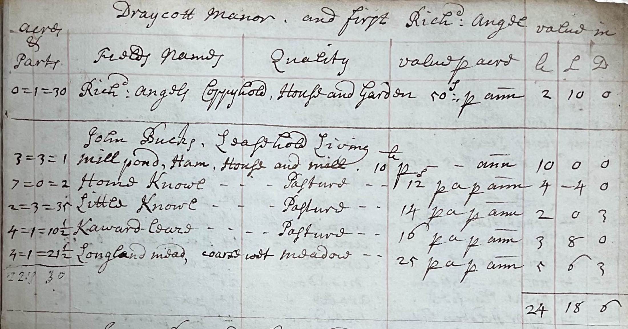
The first extract shows some of the Draycot Cerne holdings of Richard Angel: a copyhold house and garden valued at £2 10s. In fact, he was the tenant with the most land in the parish, paying a total of about £50 in rent. The Angel / Angell family was clearly quite wealthy; he left a comprehensive Last Will and Testament when he died in 1766, leaving the majority to his grandson, also called Richard. There is a memorial at the Draycot church which shows that a charity was set up for the poor of Draycot Cerne, using bequests made by Martha Angell.
John Bucks had the ‘leasehold living’ of the Mill; it used to stand on the west of the ‘road to Stanton’ (now the B4122). A later miller was called Buckland; family names varied in spelling over the years, and it is possible that ‘Bucks’ may have become ‘Buckland’ or was simply mis-spelled in this document.
For more on Draycot Cerne, see Tim Couzens ‘Hand of Fate; the History of the Longs, Wellesleys and the Draycot Estate in Wiltshire’ (ELSP, 2001).
Sutton Benger
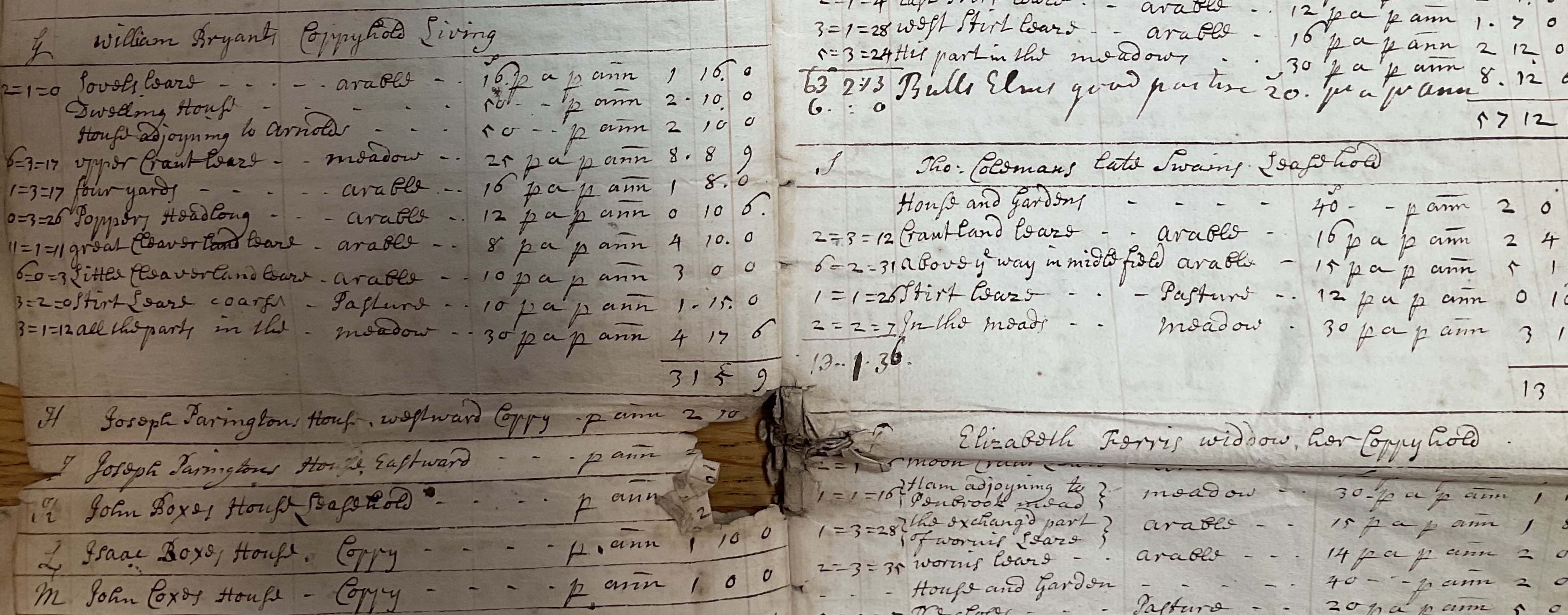
In Sutton Benger, the two houses of John Boxe and Isaac Boxe (confusingly, next to the house of John Coxe) were probably the original 'Box Cottages' (now 2-4 High Street). Note 'Bulls Elms - good pasture' (just above Thomas Coleman's leasehold house and garden); this was probably the field that is now Bull's Elms wood - see the Trail from Gate Farm to Chissell Brook and Sutton Meadows.
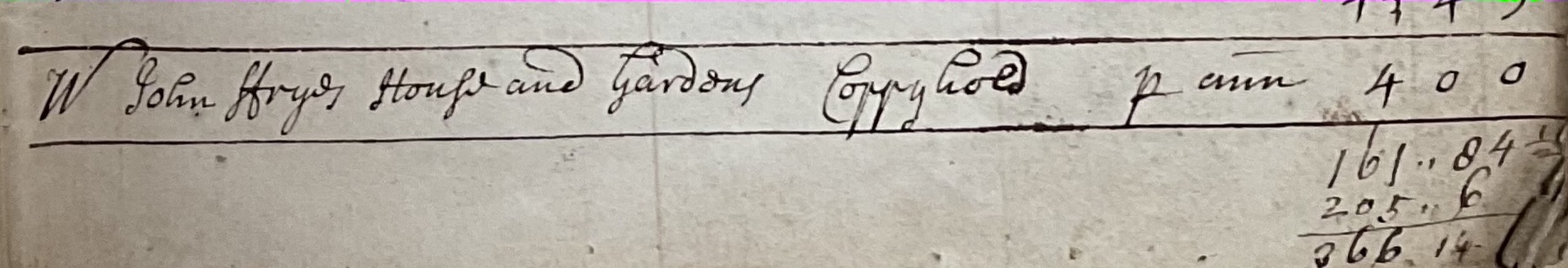
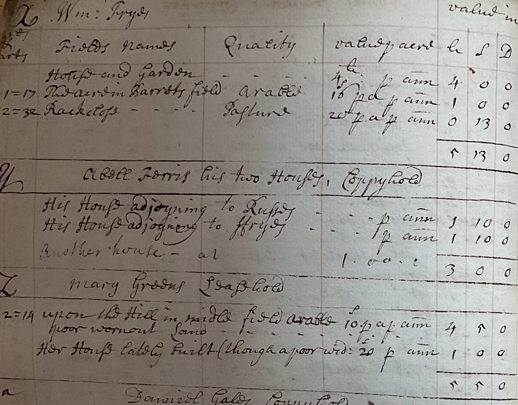
Note 'John Frye's House and Garden' followed by 'Wm Fryes ...' with a house & garden and 'The acre in Barrets field' and 'Rack close'.
John and William Fry were brothers and cloth makers. John built the house that has become La Flambé, and his son Joseph went off to Bristol and eventually started the Fry's Chocolate business.
Barrett Lane today (the spellings Barret / Barrett / Barratt have been interchangeable through the years) leads north from the High Street, and then turns right to become a footpath towards Christian Malford. This lane was known as 'the Drove to Barratts) and 'the Barratts' were the four fields to the north and south of the lane. 'Rack Close' was the field at the north east end of Barrett Lane, where the (relatively) new houses have been built beyond No 60 High Street: Paddock End, etc. It was called 'Rack Close' because it is where the cloth makers hung the cloth out on racks to dry. And William Fry's house was at the south east corner of the field, roughly to the east of where No 60 High Street ('Sutton Lodge')is today.
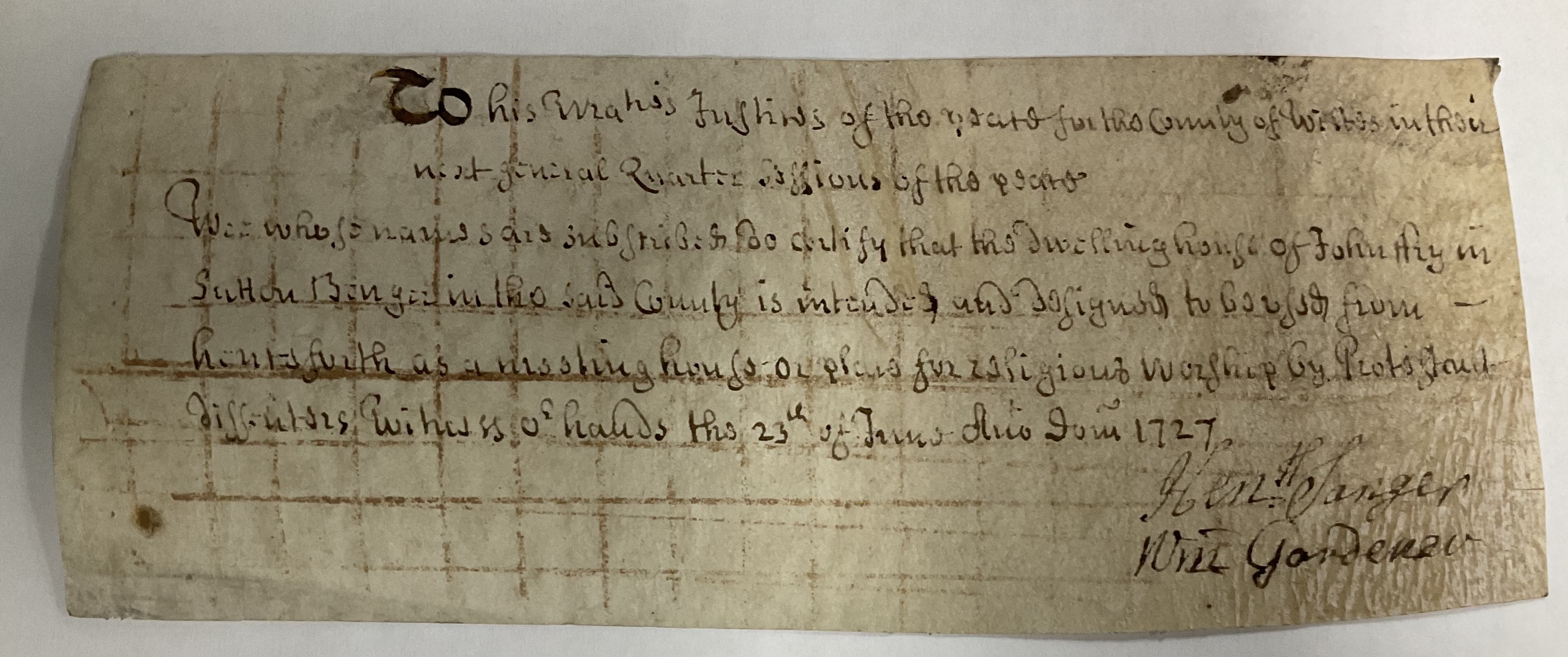
John Fry can also be found in another document in the archives, dated 1727, because he was given a licence to use his house as a Quaker Meeting House.
Do you live in the Barrett Lane area? Do you want to know more about the houses in this area of the village? Please contact us if you are interested in any of the history of Sutton Benger and Draycot Cerne.
Historical Sources
Discover more articles in the history index.
History Index