Censuses, Tithe Records, Surveys and Leases
Introduction
Censuses, Tithe Records and Estate Surveys of the 1700s, 1800s and early 1900s provide varying levels of detail about the people of Sutton Benger and Draycot Cerne over the years.
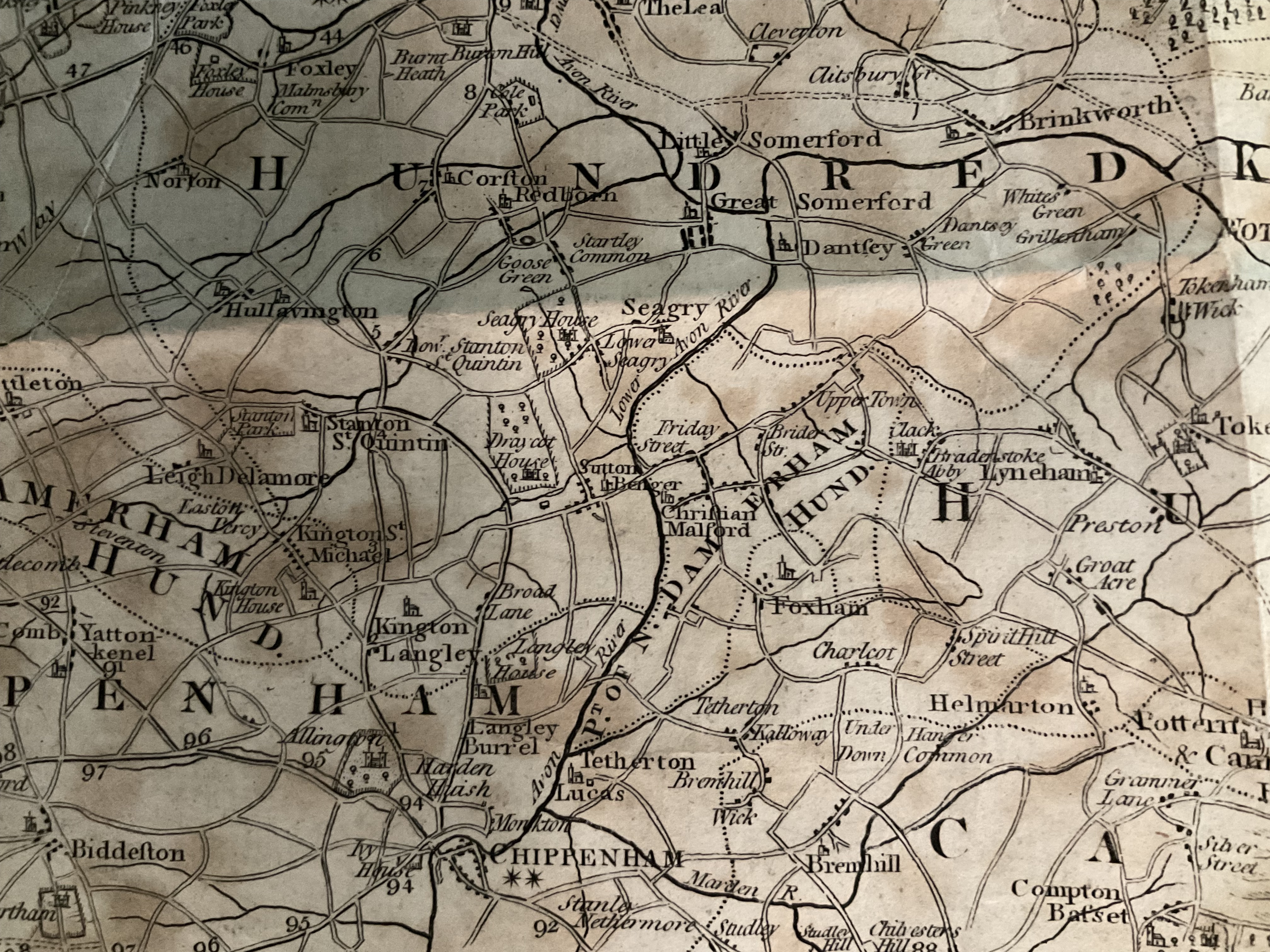
Until 1920, both Draycot Cerne and Sutton Benger were part of the Draycot Estate but were separate parishes. National surveys (such as Tithe Surveys and Censuses) were carried out for each parish, but Estate Surveys covered both parishes together.
Also, until the later 1800s, the parish of Draycot Cerne consisted of two smaller villages, or hamlets, known as Upper Draycot and Lower Draycot.
Estate Surveys
There were a number of Estate Surveys in the 1700s and 1800s which provide some similar information to Censuses but are less detailed. Some of the records are actually just collections of rental agreements. The Surveys usually give just the name of the head of family; sometimes they include the age, with some clues about where the family was living.
Tithe Surveys
Tithes were originally a tax which required one tenth of all agricultural produce to be paid annually to support the local church and clergy.
By the early 19th century tithe payment in kind was recognised as a very out-of-date practice, and payment of tithes became unpopular. The 1836 Tithe Commutation Act required tithes in kind to be converted to more convenient monetary payments called tithe rentcharge. The Tithe Survey (or Apportionment) was established to find out which areas were subject to tithes, who owned them, how much was payable and to whom. The Surveys took place in varying years as Surveyors moved from area to area around the country.
Each Tithe Survey generally included a Schedule, naming the head of each household in the parish and listing the ‘plots’ that he had, together with a numerical reference to the plots. A brief description showed the acreage for each plot and whether the plot was a house (and garden), or a field; for the latter it showed the type of crop (arable or pasture).
The Survey also listed the ‘Owners’ as well as the ‘Occupiers’; the vast majority of properties in Sutton Benger and Draycot Cerne were owned by the Lord of the Manor (William Richard Arthur Pole-Tylney-Long-Wellesley Esq, 4th Earl of Mornington) and rented by the parishioners.
There was also a Tithe Map, showing the numbered plots described in the apportionments; comparison of the two documents shows which fields each householder had.
The Tithe Survey (or Tithe Apportionment) for the parish of Draycot Cerne was dated April 1839. The Tithe Survey for the parish of Sutton Benger was dated August 1839. The two Tithe Maps were also dated 1839.
Censuses
The Tithe Surveys were followed by a Census for each parish in 1841; and then every 10 years thereafter.
The first (1841) Census recorded the name of the head of each household, as well as each other person living with him, giving ages to the nearest 5 years, and showing brief details of professions. Subsequent Censuses (1851 onwards) gave more and more information.
There were no street names or house numbers (until the 1950s), and the Census Enumerators did not necessarily have a plan as to how they listed the households. The ways in which they were recorded certainly varies from Census to Census. The majority of households are often shown simply as being in ‘Draycot’ or in ‘Sutton’; exceptions were the clergy, and prominent farmers. However, a good guess for where other families lived can often be made by comparing to the relevant Tithe Schedule or to the Estate Surveys.
Estate Surveys and Leases
The Draycot Estate Surveys and Leases covered both Draycot Cerne and Sutton Benger, as well as other parishes and properties which were part of the Draycot Estate.
Some of these documents were not actually detailed Surveys but were simply collections of leases, but they tend to give similar information to Surveys or Censuses. The leases in each collection cover a wide range of dates, and the year in the title is purely a notional date in order to give each collection a name.
See the separate documents about Estate Surveys for details of:
The 1730 Inspection
The 1744 Leases
The 1808 Survey
The 1851 Survey
The 1860 Leases
The 1872 Survey
The 1900 Leases
Historical Sources
Discover more articles in the history index.
History Index