1839 Tithe Records
Introduction
Tithes were originally a tax which required one tenth of all agricultural produce to be paid annually to support the local church and clergy.
By the early 19th century tithe payment in kind was recognised as a very out-of-date practice, and payment of tithes became unpopular. The 1836 Tithe Commutation Act required tithes in kind to be converted to more convenient monetary payments called tithe rentcharge. The Tithe Survey (or Apportionment) was established to find out which areas were subject to tithes, who owned them, how much was payable and to whom. The Surveys took place in varying years as Surveyors moved from area to area around the country.
Each Tithe Survey generally included a Schedule, naming the head of each household in the parish and listing the ‘plots’ that he had, together with a numerical reference to the plots. A brief description showed the acreage for each plot and whether the plot was a house (and garden), or a field; for the latter it showed the type of crop (arable or pasture).
The Survey also listed the ‘Owners’ as well as the ‘Occupiers’; the vast majority of properties in Sutton Benger and Draycot Cerne were owned by the Lord of the Manor of Draycot and rented by the parishioners.
There was also a Tithe Map, showing the numbered plots described in the apportionments; comparison of the two documents shows which fields each householder had.
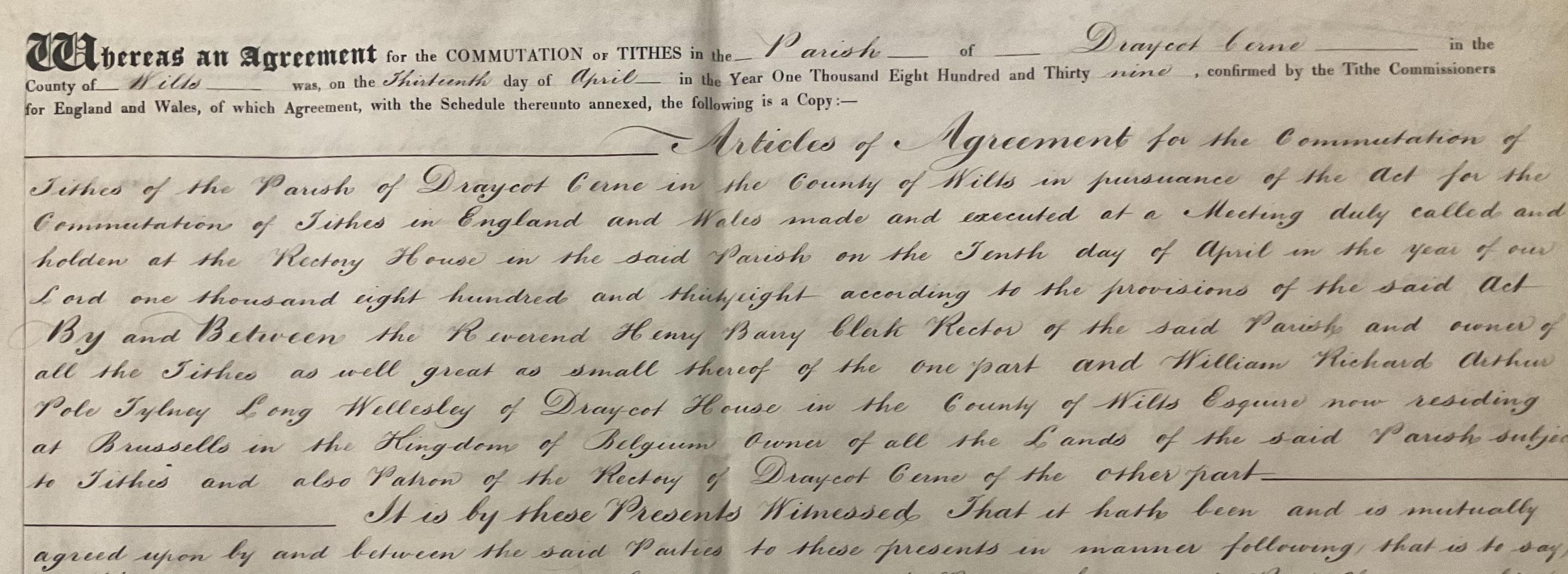
The Tithe Survey (or Tithe Apportionment) for the parish of Draycot Cerne was dated April 1839. The Tithe Survey for the parish of Sutton Benger was dated August 1839. The two Tithe Maps were also dated 1839.
Draycot Cerne
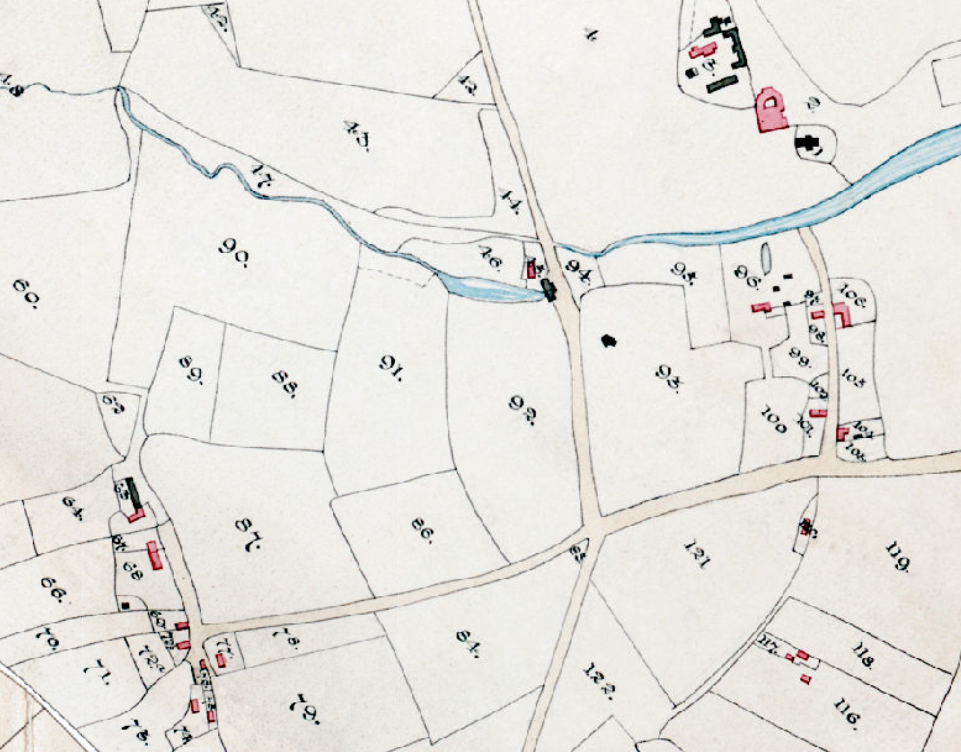
The 1839 Tithe records for Draycot Cerne show that the owner of nearly every house was the young William Richard Arthur Pole-Tyley-Long-Wellesley, who had inherited the Draycot Estate at the age of 21 in 1834; apart from Draycot House itself, he was also shown as the 'occupier' of the Draycot Park farmhouse, a cottage and the 'keeper's house'. However, as the Introductory pages note, he was in Brussels at the time of the Tithe Survey.
(For the full details about the Long-Wellesley etc family, especially in the early 1800s, see: Tim Couzens, 'Hand of Fate; The History of the Longs, Wellesleys and the Draycot Estate in Wiltshire' (ELSP, 2001).)
An exception was the schoolhouse, which was 'owned' by Revd Henry Barry, Edward Giddings, and Isaac Day, and the Trustees of the School Charity. The occupier - the schoolmaster - was shown to be William Davis.
Revd Henry Barry was also the 'owner-occupier' of the church and rectory, and also rented another house, garden and orchard in Lower Draycot. The rectory in 1839 was near the church, just south of the lake in the old hamlet of Lower Draycot.
Edwin Buckland was the miller (on today's B4122), and John Bond was the farmer at Nabal's Farm, which was then in the parish of Draycot Cerne. Other farmers were Edward Giddings (Manor Farm), Jeremiah Knight (Roward Farm), and James Lane (Lake Farm).
The Great Western Railway company had recently bought some land in the detached part of the parish, on the River Avon south of Avon Weir / Avon Mill. The Tithe Map shows the proposed line of the railway but it had not yet been built.
There were about 17 more families living in properties rented from Lord Mornington, mainly in Lower Draycot. Note that the pink-coloured buildings on the map are houses, while the black buildings are 'other' - including not just barns and outhouses but the church and the mill. The map shows not only Lower Draycot (which was completely landscaped in the later 1800s, but also some houses to the south of the main road.
Sutton Benger
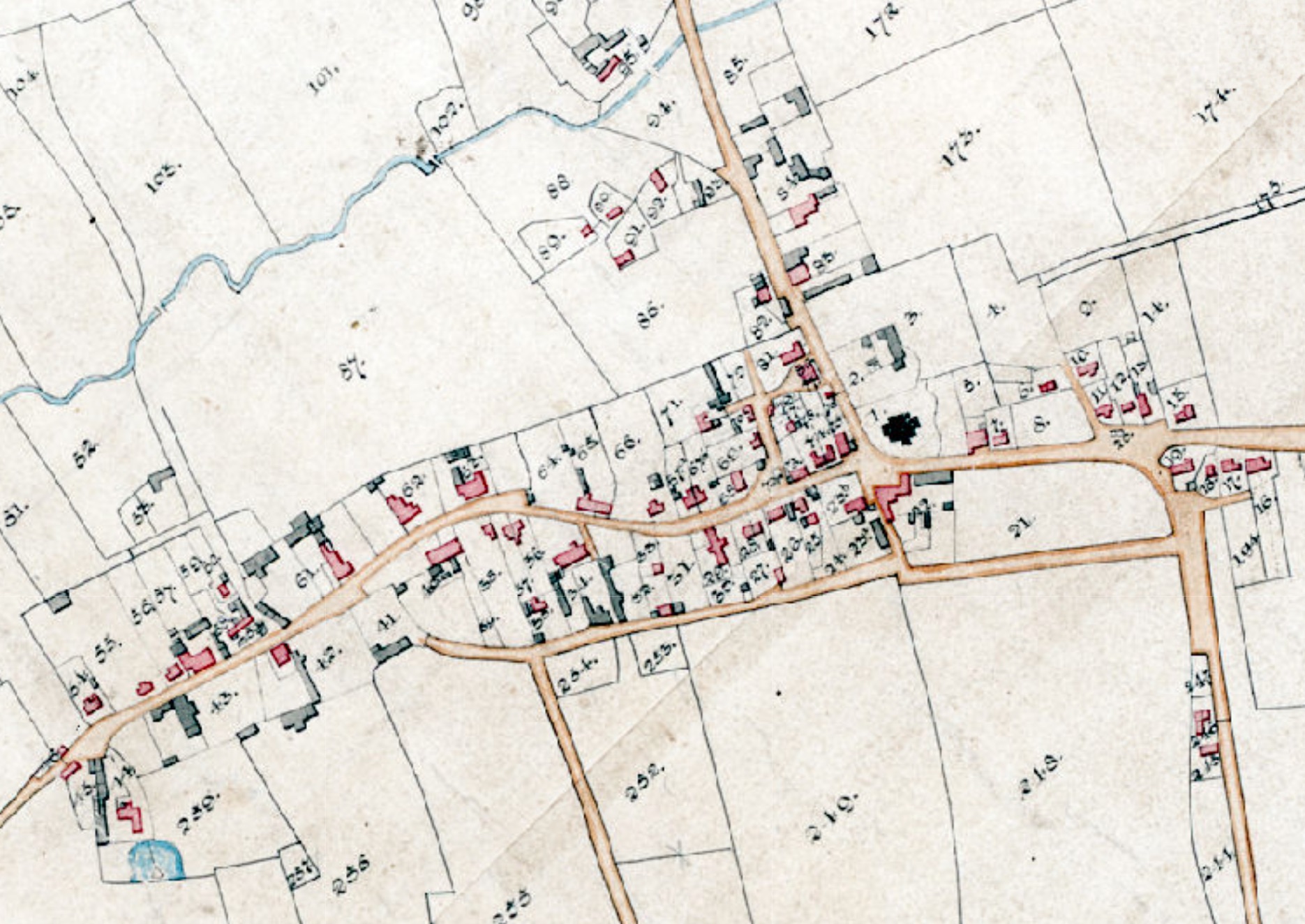
The 1839 Tithe map of Sutton Benger shows that the basic layout of the roads was much as we see them today, with some significant points of difference. There were a number of more open spaces: around the Sutton Lane junction, at the church crossroads, at the entrance to Park Lane. Back Lane (now Chestnut Road) did not connect to the High Street at the western end.
There was a group of houses west of Seagry Road and south of the brook which had disappeared by the end of the 1800s. And there was a footpath from Seagry Road to Park Lane on both sides of the Old Schoolhouse; the extra path presumably disappeared when the schoolhouse was extended a few years later.
The map also shows the location of three toll gates (small black line across the roads) at the entrances to the village: at Gate Farm, on Seagry Road and on Sutton Lane. There was also a Tollhouse on the north side of the main road (north of Gate Farm); this was demolished when the Turnpike system ended in the 1880s.
The rector was the Reverend George Thomas Marsh. Richard Hull had recently started his grocery business in the building that used to belong to the Fry family, and eventually became today's Le Flambé. Thomas Ferris was the landlord at The Bell Inn, and David Collins was the landlord at The Tylney Long Arms Inn (soon after to be re-named as The Wellesley Arms).
Historical Sources
Discover more articles in the history index.
History Index